Geographic Information Systems Gis
GIS ObjectLand v.2. 6. 2003
GIS ObjectLand is a universal Geographic Information System for Windows. Key features: - creation of vector-raster maps with arbitrary structure of layers and feature types; - creation of themes. Theme is a user presentation of a map; - control of

Thuban for Linux v.1.2.2
Thuban is an interactive geographic data viewer (GIS viewer) which features methods to visualize, explore, and analyze geographic information.
Thuban for Mac OS X 1.0.1-3 v.3
Thuban is an interactive geographic data viewer (GIS viewer) which features methods to visualize, explore, and analyze geographic information.
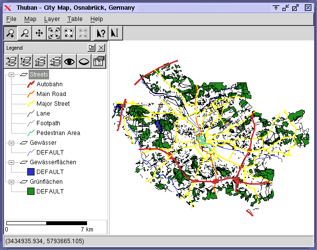
Thuban for Windows v.1.2.2
Thuban is an interactive geographic data viewer (GIS viewer) which features methods to visualize, explore, and analyze geographic information.
ArcExplorer v.4.0.1
ArcExplorer is a lightweight GIS data viewer developed by ESRI.
UCertify CISSP - CISSP practice test
Pass CISSP exam CISSP in first attempt. 561 questions with detailed explanation and 276 study notes. CISSP - Certified Information Systems Security Professional study notes, articles and mock test. 99% pass rate, 100% money back guarantee. Based on latest
GPSy v.3.40.2
GPSy is a sophisticated Macintosh GPS communications and GIS mapping program.
PostGIS v.2.0
PostGIS is unique software that adds support for geographic objects to the PostgreSQL object-relational database.
ERDAS ECW JPEG 2000 Plug-in for v.11.0.1.250
Digital imagery is becoming more and more ubiquitous as time goes by.
Distributed Information System (NZDIS) v.1.0
New Zealand Distributed Information Systems (NZDIS)Distributed, heterogenous, agent-based framework for intelligent/semantic information and services integration.
ERDAS Desktop 2011 v.11.0.3
ERDAS creates geospatial business systems that transform our earth's data into business information, enabling individuals, businesses and public agencies to quickly access, manage, process, and share that information from anywhere.
PlanetGIS Explorer v.3.0.8.5190
PlanetGIS Explorer is a free viewer for PlanetGIS maps and GIS exchange files. PlanetGIS Explorer allows you to navigate through maps, query map elements and view attribute information from linked database tables.